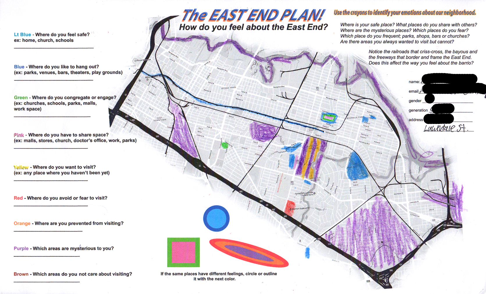
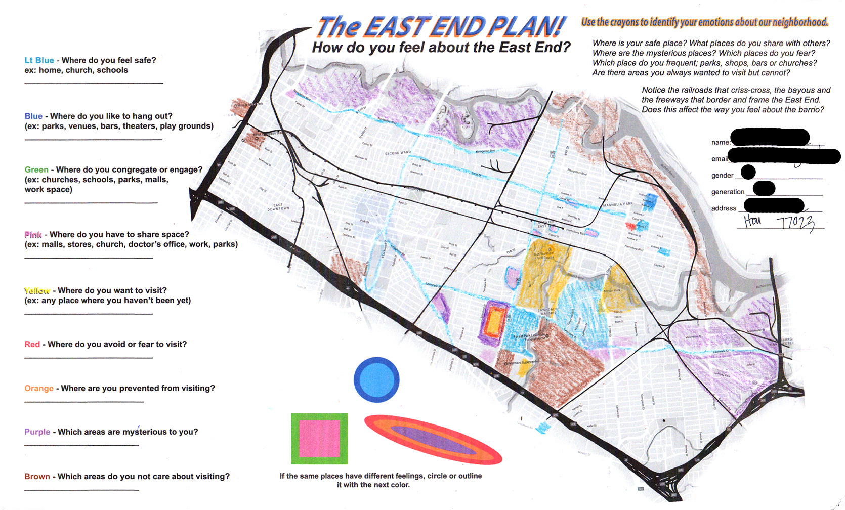
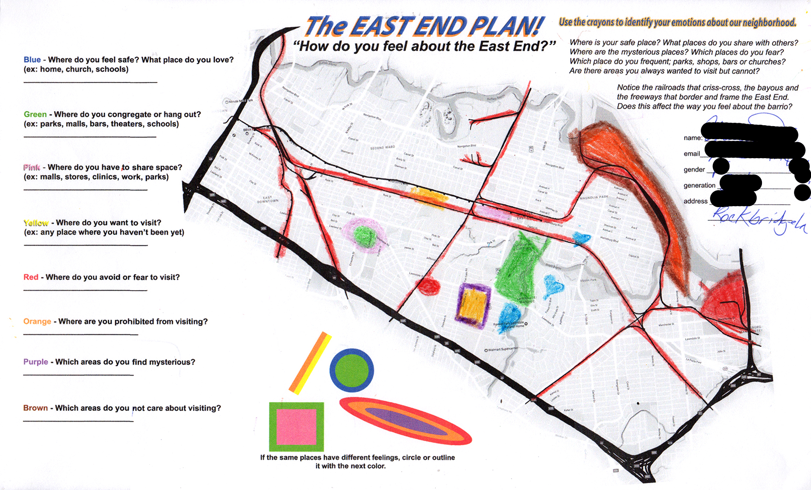
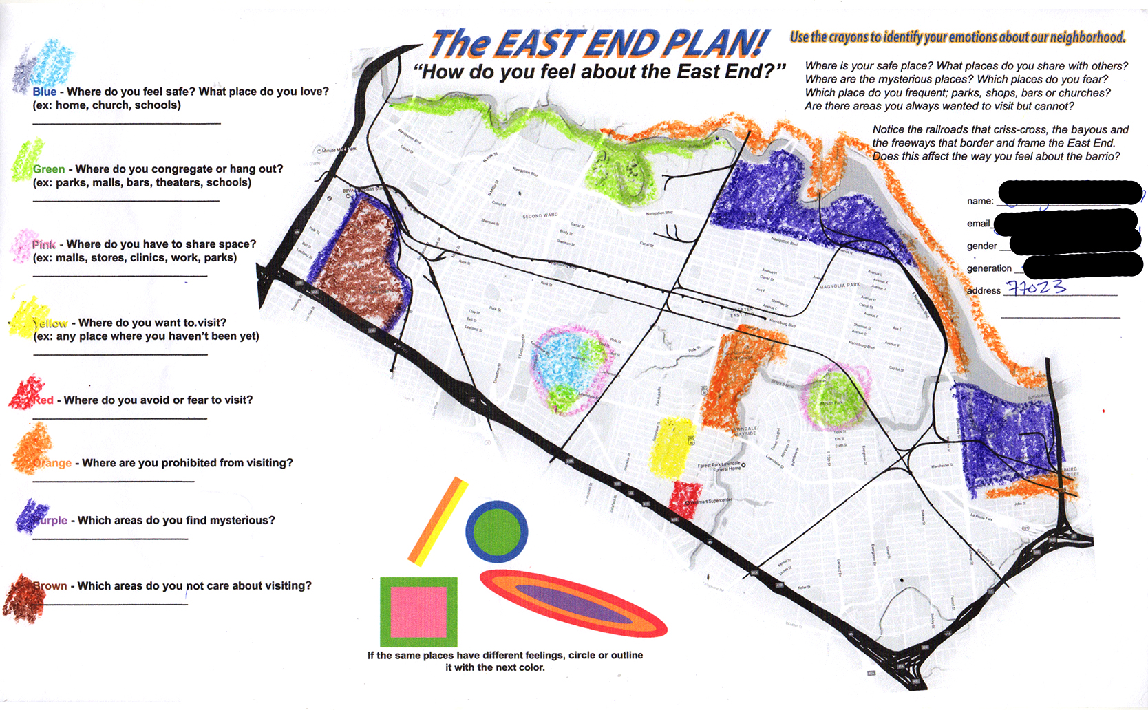
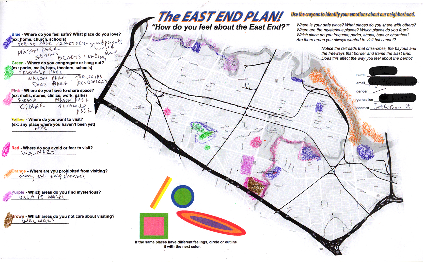
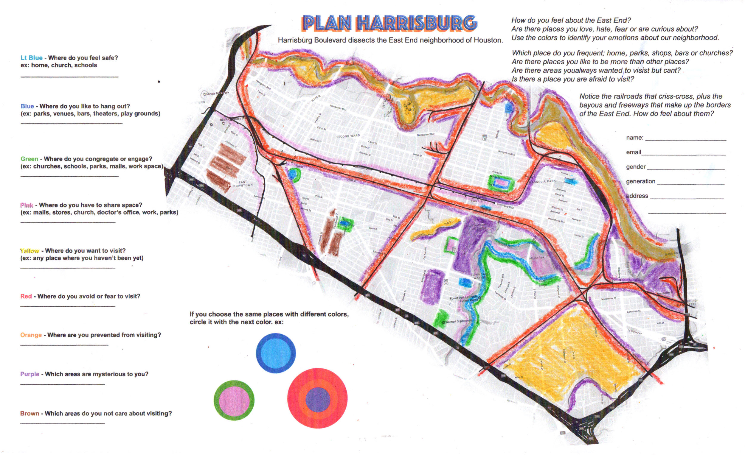
The EAST END PLAN, "How do you feel about the East End?"

The East End Plan is emotional map making. It creates a "gestalt of place" that identifies the internal perception of the resident's living in Houston's East End with their neighborhood and its geographic features. I ask participants to color in the areas on the map with crayons, according to their emotional connection to locations within their community. Color is associated with the participants "feeling" and “choices” toward the places, sites, and spaces in their community. For example: The color Blue ask's “Where do you feel safe? What place do you love?”; Green – “Where do you congregate or hang out?”; Pink – “Where do you have to share space?”; Yellow – “Where do you want to visit?”; Red - “Where do you avoid or fear to visit?”; Orange – “Where are you prohibited from visiting?”; Purple – “Which areas do you find mysterious?”; and Brown – “What areas do you not care about visiting?”
The object of this experiment is to discover the affects civic planning, commercial development and re-uses of the East End’s urban landscape have on its residents. “What are the effects on the individual perception towards open, common or private spaces that do not consider or consult with the local population?”
More map templates will be collected in the coming months. Ideally, specific bodies of map samples can come from teen and young adult students of a local high school, seniors and long time residents, or those who travel the East End for their jobs.
Its too early to declare the indications of the lack of public consultation on civic and commercial planning. The patterns of perception will reveal themselves over time.
RANDOM COLLECTED SAMPLES: April, 2017